
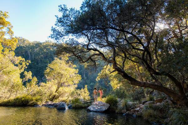
One of the top things to do in Sunshine Coast and the best way to get up close with the natural beauty of the coast and hinterland is to explore by foot.
Scenic strolls along beach-hugging boardwalks and pathways. Spectacular waterfalls viewed only a short stroll from carparks. Day-long hiking adventures through ancient rainforests. Moderate climbs to the summit of mountains embraced by Aboriginal Dreaming stories.
The area lays claim to seven national parks – more than any other region in Queensland. And whether you’re a day tripper or serious climber, hiking on the Sunshine Coast is a breeze with a variety of trails from easy well-maintained flat tracks to more difficult graded walks.
So, what are you waiting for? The great outdoors is just a step away.
The road less travelled
Coastal pathways, Photo by: Visit Sunshine Coast
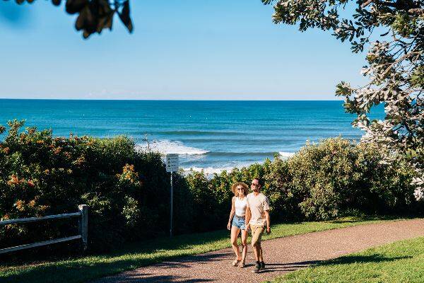
Walk, jog or cycle part of the Coastal Pathway that eventually will stretch 96km from Bells Creek in the south to Tewantin in the north. The pedestrian path hugs the dunes and takes in pandanus palm and casuarina-shaded golden sands in parts, as well as playground-filled parks, beach decks and picnic areas. The 1.6km section from Caloundra’s Bulcock Beach to Kings Beach, the 4.5km route from Bulcock Beach to Moffat Beach and the 3km section from Kawana Surf Club to Point Cartwright Lighthouse are three of the most popular at the southern end. Or join the crew from pram pushers to triathletes on any part of the section from surf club to surf club: Maroochydore and Alexandra Headland to Mooloolaba. A new beach boardwalk and viewing platform at the Alex Bluff Foreshore Park with sweeping coastal panoramas to Mooloolaba Beach and Point Cartwright has just opened as part of the first stage of the new Northern Parkland on this part of the Coastal Pathway.
A beach break
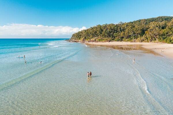
Noosa main beach, Photo by: Tourism Noosa
Few travellers go past the chance to dive headfirst into a day at the beach on arrival. With more than 130km of coastline, the Sunshine Coast is the perfect place for a saunter along the water’s edge. Kick off the shoes and choose your spot – from Rainbow Beach’s coloured sands, surf mecca Double Island Point and Noosa’s Main Beach on spectacular Laguna Bay in the north, through rocky headlands, little coves and stretches of open surf breaks with household names such as Peregian, Coolum, Maroochydore, Mooloolaba and Kawana Waters to the calm waters of Bulcock Beach on Pumicestone Passage in the south. The beach walk from the new dunal observation deck at Bokarina to family friendly Currimundi Lake is a local favourite, and you can return via Currimundi Lake (Kathleen McArthur) Conservation Park and under the leafy canopy of the Coastal Pathway.
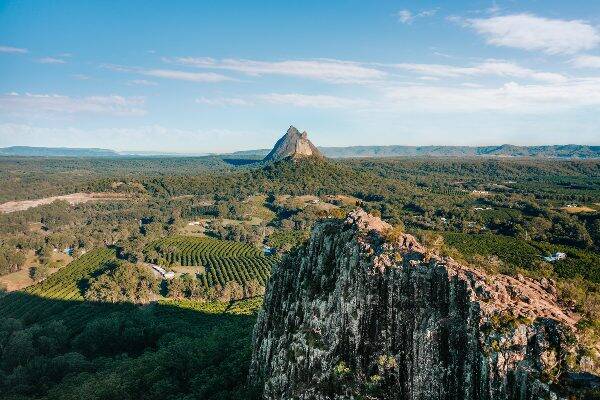
Rockin' the landscape
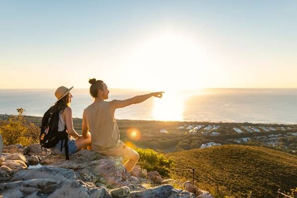
Mt Coolum, Photo by: Visit Sunshine Coast
Mt Coolum: 1.5 km return
Any mention of hiking on the Sunshine Coast has to include Insta-worthy favourite Mt Coolum that has been 26 million years in the making. At 208m, the dome-shaped rock that dominates the landscape is our second-largest monolith after Central Australia’s Uluru. The walk to the summit is a joy for young and old, securing holiday snaps of Point Cartwright to the east, the Glasshouse Mountains to the south, the Blackall Range to the west and Noosa Heads to the north.
National Icon
Coastal pathway, Photo by: Visit Sunshine Coast
Noosa National Park Coastal Track: 10.8km, Palm Grove Circuit: 1km, Noosa Hill Track: 3.4km, Tanglewood Track to Hell's Gates: 6.9km
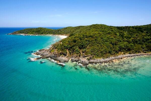
From bushwalkers, nature lovers and picnickers to surfers and yachties, Noosa National Park attracts people from all over the globe as one of Australia’s most frequently visited national parks. It’s also one of the most accessible and easiest to tackle by foot. Wildlife are just as enamoured with the beauty, so keep watch for coastal and migrating bird species, dolphins, turtles and humpback whales (during the migration season from about late-May to early November). The park is an ideal place to start hiking on the Sunshine Coast as it caters for all fitness levels. A stroll to First Point when the surf is pumping will provide hours of amusement watching short- and longboarders take on the National Surfing Reserve’s world-famous peeling waves.
Mountains of fun
Mt Ngungun, Photo by: Visit Sunshine Coast
Mt Ngungun: 2.8km return
The Glasshouse Mountains – with their craggy peaks, well-defined trails and jaw-dropping lookouts – deserve their place as a landscape of national significance.
The 13 volcanic peaks were named by Captain James Cook in 1770 after the glass furnaces in his home county of Yorkshire, England. But the area was first explored by a European in 1799, when Captain Matthew Flinders called into the region during his circumnavigation of the continent.
While the highest peak is Mount Beerwah at 556m above sea level, Mount Tibrogargan at 364m is perhaps most identifiable, closest to the Bruce Highway that connects the Sunshine Coast with Brisbane. The most popular summit walk is up Mt Ngungun, where the rewards are spectacular 360-degrees views taking in nearby Mt Tibrogargan, Mt Tibberoowuccum, Mt Coonowrin and Mt Beerwah. This well-defined track has some steep sections. The Glasshouse Mountains is ideal for hiking on the Sunshine Coast. But for more leisurely walks with that majestic mountain backdrop, head to:
• Mary Cairncross Scenic Reserve, Mountain View Rd, Maleny
• Wild Horse Mountain Lookout in Beerburrum State Forest, east of the Bruce Highway, above the service station.
• Glasshouse Mountains Lookout on Glasshouse-Woodford Rd, Beerburrum
• Bulcock Beach Esplanade.
Walking with purpose
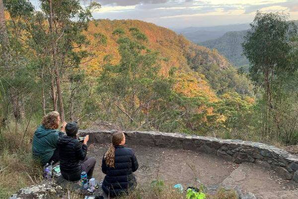
Sunshine Coast hinterland great walk, Photo by: Lauren Pearson© – The State of Queensland
Sunshine Coast Hinterland Great Walk: 58km.
Those wanting to lace up the boots for a hiking holiday can conquer the Sunshine Coast Hinterland Great Walk. This four-day, grade 4 trek abounds in warm subtropical rainforest, tall open eucalypt forest and tranquil waterfalls in secluded areas of the Blackall Range. It has four main sections: Section 1: Baroon Pocket Dam to Flaxton walkers’ camp (16.1km one way, allow 7hrs); Section 2: Flaxton walkers’ camp to Ubajee walkers’ camp (13.1km one way, allow 7hrs); Section 3: Ubajee walkers’ camp to Thilba Thalba walkers’ camp (13.5km one way, allow 7hrs); Section 4: Thilba Thalba walkers’ camp to Delicia Road entrance (16.1 km one way, allow 9-10hrs). Or try some of the shorter half-day or full-day legs. Bush campsites are available, and drop-off/pick-up services for walkers on the Sunshine Coast Hinterland Great Walk are provided by some local accommodation operators.
Falling for Kondalilla
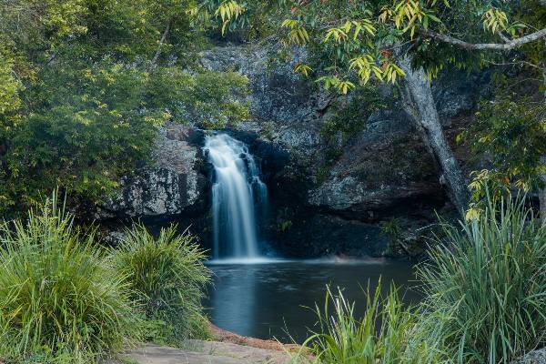
Kondalilla Falls, Photo by: Visit Sunshine Coast
Picnic Creek Circuit: 1.7km, Rock Pools Walk: 3.2km, Kondalilla Falls Circuit: 4.7km
The Blackall Range’s Skene Creek drops 90m into a rainforest valley to create a very cool hinterland wonder: Kondalilla Falls. Located in Kondalilla National Park near the town of Montville, the trails are part of the first section of the Sunshine Coast Hinterland Great Walk. The carpark and large grassy picnic area lead down to the easy Picnic Creek circuit through forests offering eucalypt and rainforest species with a lookout over the valley and the moderate Rock Pools Walk. Kondalilla Falls Circuit follows part of the Picnic Creek loop down the escarpment, past rock pools and a lookout with views of the falls, through rainforest to the base of the cascades and back up the ridge. Swimming is safe in the rock pools but be warned: the water temperature can be brisk, even in summer!
Art and exercise
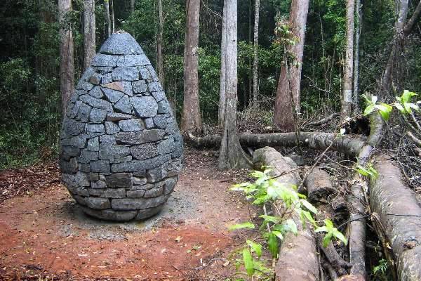
Strangler Cairn, Photo by: Omar Bakhach © The State of Queensland
Strangler Cairn walk: 6.5 km return
The surprising 3.7m tall Strangler Cairn by world-renowned British artist Andy Goldsworthy is a quirky encounter for hikers taking the short side track off the Conondale Great Walk between the Gold Mine track and the Artists Cascades. The pine-cone sculpture is made of granite blocks from a nearby quarry. A strangler fig tree has been planted in the pointy top. The fig’s roots over time will grow down and through the cairn to transform its look. The always evolving piece of art just may become an international icon one day. Access to the track’s starting point is by four-wheel drive, or park your two-wheel-drive vehicle 3km further back and add the distance to the walk. The main track is through sub-tropical rainforest and wet sclerophyll forest.
Oasis in the bush
Booloumba Falls, Photo by: Visit Sunshine Coast
Booloumba Falls: 3km return
Booloumba Falls is another highlight of Conondale Range Great Walk. The grade 3 hike in Conondale National Park takes about two hours to complete and you can drive to the falls car park, just under 10km from the Booloumba Creek day use area. The turn-off to Booloumba Creek Road is about 13 km past Conondale. The Booloumba Falls Walk takes visitors through tall open forest to the junction of Peters and Booloumba creeks, marked by The Breadknife rock formation. Booloumba Gorge features a lookout over gentle cascades, a two-part waterfall and series of crystal-clear rock pools with cool mountain water beckoning you for a dip before the return journey.
Tunnel vision
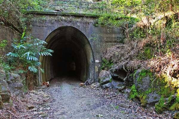
Dularcha Tunnel, Photo by: © Ross Naumann, QPWS volunteer
Tunnel: 93.5m. Enter the tunnel via a 500m or 2km walk on the Landsborough side or the 900m walk from Mooloolah
The Heritage-listed Dularcha Forest Tunnel Walk is a hidden gem in the southern hinterland between Landsborough and Mooloolah that many locals don’t know about. It is one of two tunnels built on the original narrow-gauge North Coast Line between Brisbane and Gympie and was completed in 1891. Today’s long curved tunnel offers a dark, protected environ for the seasonal roosting of a variety of small bats. The surrounding national park’s eucalypt forests and riparian areas with flooded gums, cabbage tree palms and rainforest plants ensure wildlife spotters and birdwatchers on the trails have plenty to see, especially at dawn and dusk.
History on track
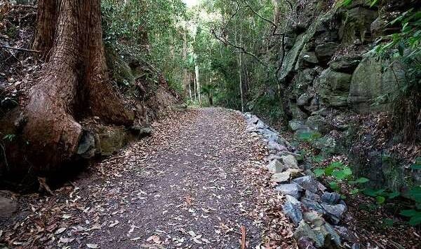
Buderim Palmwoods Heritage Tramway, Photo by: Steve Bass Photography
Buderim Palmwoods Heritage Tramway Walk: 3.7km return
Buderim Palmwoods Heritage Tramway Walk is one of the best hikes on the Sunshine Coast for families. The easy 3.7-km out-and-back trail starts and finishes on the comer of Mons and Telco Rds and takes under an hour to complete. The peaceful walk through history marks the route of the old steam tramway that connected the then fledgling areas. The Krauss locomotive was used from 1914 to 1935 to carry produce from the heart of Buderim to Palmwoods for distribution to Brisbane. Once road transport became more financially viable, the train was decommissioned and the railway tracks removed. The gentle gradient of the old tramway path passes through the rainforest, past Telco Station, Mons Station and the cutting to a housing estate and returns by the same route. Beautiful views from numerous vantage points, forested slopes and birdlife are highlights. The section of the track between 800m and 1600m is perhaps the most interesting and still has old railway sleepers embedded in the soil.